On July 18, 2024, the staff of the Institute of Management of STU in Bratislava, Department of Spatial Planning, carried out a work trip to the villages of Ratiboř in Bohemia and Horné Sŕnie in Slovakia. These municipalities are partners in the BeReady project – Urban heat islands REsilience, preparedness and mitigation strategy (Interreg Danube Region Programme). The project focuses on the identification of urban heat islands (UHI) in the countries of the Danube region, taking into account approaches based on ecosystems. The aim of the project is to provide municipalities with tools and solutions for UHI vulnerability assessment and to propose procedures for designing measures and creating policies related to addressing the impacts of climate change.
During the meeting on July 18, 2024, we discussed the measurement of climate data at the local level. Institute of Management of STU in Bratislava, as one of the scientific partners of the Be Ready project, presented the measurement possibilities, informed about the possibilities of collecting and transmitting climate data and presenting them to the public and to the local government (Fig. 1). We also discussed about the possibilities of using local climate data in decision-making processes and in spatial planning.
During the visit, we carried out a tour of the terrain and measured surface temperatures with a thermal camera (Fig. 2 and Fig. 3). There were no meteorological warnings reported in Ratiboř or Horné Sŕnie for the given day but we still measured extreme surface temperatures. Figure 2 shows examples of surface temperature measurement at UHI in Ratiboř and Figure 2 shows UHI in Horné Sŕnie. The maximum surface temperatures were around 75 Celsius degree. These were temperatures measured on reinforced, impermeable surfaces. Surface temperature measurements were carried out in the built-up area of municipalities, in places without vegetation elements and without elements of the blue infrastructure on the surface. At the same time, these were areas that are intensively used by citizens (bus stop, footpath, cemetery near the church and others – see Fig. 4).
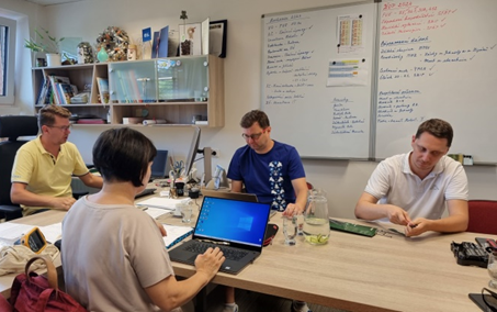
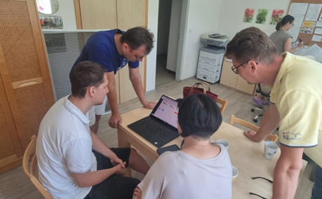
Fig. 1: Working meeting at the Municipal authority in Ratiboř and in the Kindergarten building (July 18, 2024, author: E. Škurlová)
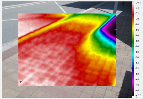
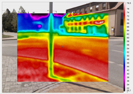
Fig. 2: Ratiboř: thermal images of the surfaces of the urban heat islands (18.7.2024, author E. Pauditšová)
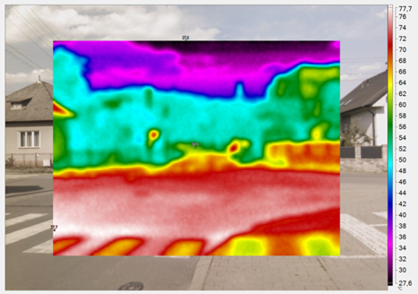
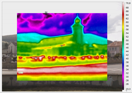
Fig. 3: Horné Sŕnie: thermal images of the surfaces of the urban heat islands (18.7.2024, author E. Pauditšová)
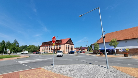
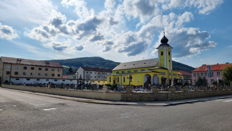
Fig. 4: Urban heat islands in Ratiboř (left) and Horné Sŕnie (right) (18.7.2024, author: E. Pauditšová)